Flatbush Rezoning Proposal will define the future of Victorian Flatbush

Update, 2009-07-29: Flatbush Rezoning Proposal approved by City Council
Update, 2009-03-02: DCP certified the proposal.


David Parish, DCP, describing the proposed rezoning for South Midwood
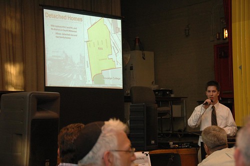
David Parish describing the proposed rezoning for South Midwood

Last night I attended Brooklyn Community Board 14’s (CB14) preliminary public hearing on the NYC Department of City Planning’s (DCP) rezoning proposal for the northern half of CB14, ie: Flatbush. I didn’t take a head count, but roughly 100 people turned out to attend the hearing in Public School 249’s uncooled auditorium. CB14 chair Alvin Berk informally explained the context and ground rules for the meeting, then officially called the hearing to order at 7:23. After the school guard kicked us out – gently, but firmly – after 9:30pm, conversations continued onto the school plaza and sidewalks. I didn’t get home until well after 10pm last night.


Some highlights:

  • One of the four major goals of the proposal is to preserve the existing free-standing single- and two-family homes that characterize the area. On this point, support seemed unanimous, although the terms detached, semi-detached, and attached were new to some in the room and is the cause of some confusion.
  • Not only Ditmas Park West, but South Midwood would be rezoned to R4A. This was the most troublesome part of the proposal at last night’s hearing; nearly all who spoke during the public comments section of the meeting (including me) opposed this particular zoning designation, for reasons explained below.
  • While current zoning puts many of these homes and streets at risk from development, the proposed rezoning may endanger even more.
  • Zoning is a blunt instrument. Currently available zoning designations are insufficient, or at least too coarse, to reflect and respect the existing housing stock in these neighborhoods.

My report will necessarily be incomplete. This was the first time I’ve ever attended a public hearing, so I had only a general idea of what to expect. I had not seen the details of the proposal prior to the meeting. My main purpose in attending the meeting was to learn more details. Unfortunately, there was no opportunity to study the large, detailed exhibits that DCP brought with them. There was only the presentation, and I was writing furiously to try to capture details as they were presented. I also had an opportunity to speak during the public comments section of the meeting. After I spoke, I was out of the room for a few minutes while I (unsuccessfully) sought water. I missed a few speakers during my absence.

The study area

The study area encompasses nearly all of the northern half of CB14. Here’s a detailed map of the study area provided by DCP.

Boundaries of the Study Area
DCP Flatbush Neighborhood Rezoning Study Area

This map of the existing zoning districts was also provided by DCP. To view the map more clearly, follow the link from the map to its Flickr page (just click the image), then select All Sizes > Original.

Existing Zoning
DCP Flatbush Neighborhood Rezoning Existing Zoning

Nearly all of the study area is zoned for residential use. The few commercial-only districts are at the edges. The C4-3 district at the southeast corner of the area is Brooklyn Junction, the intersection of Flatbush and Nostrand Avenues. The largest commercial area is the C4-2 district on the eastern boundary of the study area. This is bounded roughly by Flatbush and Bedford Avenues on the west and east, and Church Avenue and Cortelyou Road on the north and south. Important commercial/retail landmarks in this district include Sears and the Kings Theater.

Loew’s Kings Theater, Flatbush Avenue, just north of Beverly Road
Loew's Kings Theater, Flatbush Avenue

Most of the commercial space is provided as commercial overlays, shown with hatch marks on the map. You can see these along Nostrand and Flatbush Avenues, Church Avenue, Coney Island Avenue, Cortelyou Road, and Newkirk and Foster Avenues. The overlay that spans Newkirk and Foster Avenues at the Newkirk Avenue subway station is Newkirk Plaza.

589-597 Coney Island Avenue
589 (left), 591, 593, 595 and 597 Coney Island Avenue

Cortelyou Road, south side, looking west from Westminster Road

Newkirk Plaza, looking south from Newkirk Avenue toward Foster Avenue. The subway cut is on the right of the photo.
Newkirk Plaza

Within the study area, there’s a wide range of density in residential districts, from R1-2 to R7-1. R1 through R5 are lower-density districts. R6 and R7 are medium-density. There’s also a wide range of housing types.

There are three landmarked historic districts typified by free-standing homes. You can easily locate these on the map by the R1-2 districts. From north to south, they are Prospect Park South, Ditmas Park, and the recently approved Fiske Terrace-Midwood Park. Midwood Park is the southernmost R1-2 area, and Fiske Terrace is the R2 area just south of that. Both R1-2 and R2 allow only single-family detached houses.

Our detached houses are not limited to the landmarked areas. The majority are not landmarked, occupying residential zones ranging from R2 to R6. Those in R6 zones – including those in my neighborhood of Beverley Square West – are at greatest risk.

Summary of the Proposal

The proposal is still only a draft, so all the specifics are still subject to change before the formal proposal, which kicks off the ULURP process. There are four major goals for the rezoning:

  1. Preserve the existing free-standing (detached) single- and two-family houses.
  2. Match new zoning to existing buildings as closely as possible without “under zoning”.
  3. Encourage creation of affordable housing through incentives.
  4. Create opportunities for commercial growth.

In rezoning projects, one of the things DCP looks at is “non-compliance”: does existing development on a site comply with what’s allowed by its zoning designation? Non-compliant and under-zoned describe the same situation: the former applies to the house, the latter to the zoning of the property. Non-compliant does not necessarily mean illegal. The conditions may have pre-dated the zoning; in a neighborhood of homes over 100 years old, they likely do. To understand non-compliance, we need to know the current zoning designation and what it permits.

Case Study: Beverley Square West

Beverley Square West is bounded by Beverly and Cortelyou Roads on the north and south, and the B/Q subway cut and Coney Island Avenue on the east and west. The homes here are detached, single- and two-family homes with peaked roofs, most of which were built in the late 1890s and early 1900s. Most of the lots are 50 feet wide by 100 feet deep.

308 Stratford Road, Beverley Square West
308 Stratford Road

This map shows the outlines of buildings on all properties in the area. The detached homes stand in contrast to row houses along the southern side of Cortelyou Road and the eastern side of Coney Island Avenue.

Single- and Two-Family Homes and existing Structures, Beverley Square West

Most of the area is zoned R3-2, with R6 zoned along the western and southern boundaries.

Existing Zoning, Beverley Square West

Neither R3-2 nor R6 match the existing character of the neighborhood. R3-2 allows not only detached homes but semi-detached homes – side-by-side – as well as fully attached homes, ie: rowhouses. R3-2 specifies a minimum lot width of 40 feet for detached houses, but only 18 feet for semi-detached or attached.

The base floor-to-area ratio (FAR) for R3-2 is .5, or 50%. A typical lot is 50′ wide by 100′ deep, for a total lot area of 5,000 square feet. 50% of that is 2,500 square feet, the maximum permitted floor area for a building with a flat roof. R3-2 also carries an attic allowance, which encourages preservation and development of homes with peaked roofs, of .1, for a total FAR of .6. Since the typical lot area here is 5,000 square feet, 50 x 100, and 60% of that is 3,000 square feet, a house with 3,000 square feet or less is compliant with the .6 FAR. Our house, for example, is 2,750 square feet, as it’s been since it was converted from a single-family to a two-family home in the 1930s, during the Great Depression of that era.

R6 is a medium-density designation and allows for much denser development, typified by this new condo building recently completed at the corner of Stratford and Cortelyou Roads.

1103 Cortelyou Road

The R6 districts are at greatest risk from being torn down for new development. In Ditmas Park West, several homes have already been lost to teardown. To achieve the first goal of the rezoning project, preservation of the existing detached homes, the new zoning must allow only detached houses. Zones which permit only such housing are R3A, R3-X, R4A, and R5A. To preserve the scale of the neighborhoods, the new zoning must come close to the existing FAR of the homes already built. Both R3A and R3-X share the .6 FAR of R3-2. R3-X has the larger minimum lot width, at 35 feet. Of currently available zoning designations, R3-X comes closest to what’s already in place in Beverley Square West. In fact, the current draft of DCP’s zoning study proposes R3-X for both Beverley Square West and East.

Case Study: South Midwood

A house in South Midwood
House in South Midwood

Many of those attending the meeting seemed to be from South Midwood, one of the many neighborhoods that comprise the “Victorian Flatbush” part of Flatbush. The current and proposed zoning for this neighborhood provides a good case study for what’s at stake: the risks to the area from current, inappropriate zoning; the strategies DCP employs when trying to select new zoning most likely to be approved; and the issues with the new designation DCP selected. Also, it’s the only section of the presentation for which I got some usable photographs.

This neighborhood was developed at the turn of the 20th Century, before zoning existed. When the current zoning was established in 1961 (more or less), over 45 years ago, there was little consideration for what was already in place, and whether or not the new zones fit the existing context.

Ditmas Park West and South Midwood, the areas to be rezoned R4A, have a mix of zoning, the majority of which is R3-2. As explained above, R3-2 allows a FAR of .6: .5 base, plus an attic allowance of .1. R4A allows a .9 FAR: .75 base, plus a .15 attic allowance. The R4A FAR of .9 is an increase of 50% over what’s permitted today. It’s this large increase in FAR that raises concerns for residents in these two neighborhoods, who are concerned it will open the door for expansion and enlargement of existing homes, or new development, out-of-scale with the existing homes.

South Midwood, Current Zoning

South Midwood, Proposed Zoning
South Midwood, proposed rezoning

Another house in South Midwood
A house in South Midwood

DCP’s rationale for proposing R4A over R3-X comes back to the issue of under-zoning. They look at the existing buildings to see whether or not they are compliant with the current zoning. When rezoning, they try to assign a new designation in which 75-80% of existing structures would be compliant. This numeric goal arises from practical and political considerations: they want to minimize objections to the rezoning proposal from property owners concerned that their options for expanding or enlarging their homes are being restricted.

However, the situation here is different. By DCP’s calculations, only 51% of existing homes in South Midwood are compliant with the FAR of their current zoning, mostly .6 FAR in the R3-2 district. But the homeowners here are not complaining about lack of expansion options. They are concerned for the future character of their neighborhood caused by an increase in FAR of 50%.

This is one reason why I referred to zoning as a “blunt instrument” at the beginning. There’s no zoning designation which permits only detached houses with a FAR between .6 and .9. To reach their goal of 75-80% compliance – a threshold determined by political efficacy, not a legal mandate – DCP has to leap to the next available FAR of .9 in R4A. But this leap has generated opposition which the threshold was intended to avoid. An intermediate total FAR, of .75 say, which would be an increase of only 25% instead of 50%, would be a better fit and would not receive the same level of opposition. Barring creation of a new zoning designation, residents speaking at Thursday’s meeting called for a new designation of R3X, maintaining the status quo, instead of R4A, which would open up the neighborhood to out-of-scale development.

Related Posts

Flatbush Rezoning Proposal, May 23, 2008
Preserving Livable Streets: DCP’s Yards Text Amendment, November 7, 2007
Victorian Flatbush at risk from inappropriate zoning, October 23, 2007
State of Flatbush/Midwood, October 5, 2007
Landscape and Politics in Brooklyn’s City Council District 40, February 14
NASA Earth Observatory Maps NYC’s Heat Island, Block by Block, August 1, 2006

Important DCP Links

Residence District Zoning Explained
Table comparing R1 through R3 (PDF)
Table comparing R4 through R5 (PDF)
DCP Zoning Glossary

Other Links

South Midwood Residents Association
Brooklyn Community District 14 Profile (PDF)

Sunday, April 27: Sustainable Flatbush Street Tree Walking Tour

Updated 2008.04.21: Added Google Map.


Westminster Road, Beverley Square West, looking north from Cortelyou Road

On Sunday, April 27, in celebration of Arbor Day weekend and Spring in bloom, join Sustainable Flatbush and others as we take a walking tour of one of our neighborhood’s greatest assets: our street trees.

Experience the neighborhood’s amazing wealth of street trees — including some that are more than 100 years old!

Throughout the tour, your street tree guide will:

  • Identify trees and their characteristics
  • Share interesting facts
  • Explore local tree history
  • Discuss the many ways street trees benefit the environment
  • Explain how to obtain and care for street trees

and much more!

Newly Planted Street Tree on Cortelyou Road

Credit: Keka Marzagao
Flyer for Sustainable Flatbush Street Tree Walking Tour

WHEN:
Sunday, April 27, 2008, Arbor Day Weekend, 1:00 PM – 4:00 PM

LOCATION:
Tours start and finish at 1414 Cortelyou Rd, the office of NY State Assembly Members James Brennan and Rhoda Jacobs. The tour will loop through the neighborhoods of Beverley Square West and the landmarked Prospect Park South Historic District.

DIRECTIONS:
Take the Q train to Cortelyou Rd. and walk one block west (left), toward Marlborough Rd., after exiting the station.

SPECIAL DETAILS:
The tour is just about a mile in length and will take place rain or shine.
Please dress appropriately for the weather and the walk.


View Larger Map

Tree identification with Trees NY at Greening Flatbush
Tree ID, Greening Flatbush

ABOUT SUSTAINABLE FLATBUSH: Sustainable Flatbush provides a neighborhood-based forum to discuss, promote and implement sustainability concepts in Brooklyn and beyond.

Hydrant and Tree, 297 Westminster Road, Beverley Square West

Related Posts

Factoids: Street Trees and Property Values, December 2, 2007
Factoids: NYC’s Street Trees and Stormwater Reduction, November 15, 2007
Basic Research: The State of the Forest in New York City, November 12, 2007

Links

Street-Tree Walking Tour next Sunday!, Sustainable Flatbush
Trees NY

Hanami at the Brooklyn Botanic Garden

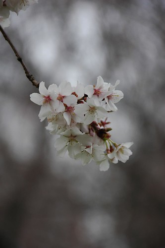
Prunus ‘Okame’ in bloom yesterday afternoon, along the Cherry Walk and adjacent to the Cherry Esplanade at the Brooklyn Botanic Garden.
Prunus 'Okame'

Tomorrow, Saturday, April 5, the Brooklyn Botanic Garden kicks off its annual Hanami, the cherry blossom season:

Hanami is the Japanese cultural tradition of viewing and cherishing each moment of the cherry blossom season. At Brooklyn Botanic Garden, Hanami is a New York City “rite of spring.”

Visitors can stroll under a canopy of cherry trees, view artwork inspired by cherry blossoms in the Steinhardt Conservatory Gallery, savor special Japanese entrees at the Terrace Café, and browse a special Hanami Shop.

Hanami runs through May 11, culminating in a celebratory crescendo with Sakura Matsui on May 3 and 4.

Here’s a detail of Okame’s flower:

Prunus 'Okame'

Here’s how the tree looks, peaking through the other cherries, still in bud. One of the entrances to the Japanese Garden is along the path sloping down on the left.

Cherry Walk

This is Prunus sargentii ‘Fudansakura’, blooming just northeast of the Cherry Esplanade, near the northern entrance to the Cherry Walk.

Prunus sargentii 'Fudansakura'

Prunus sargentii 'Fudansakura'

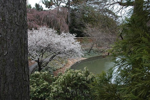
There’s another beautiful specimen in full bloom within the Japanese Garden, here viewed from the other side of the fence.

Japanese Garden

BBG updates its CherryWatch Blossom Status Map weekly. Only a handful are in peak bloom right now. Most are still in bud and haven’t yet started blooming. But a few warm days, especially sunny ones, will change that quickly.

BBG CherryWatch Map as of 4/4/2008

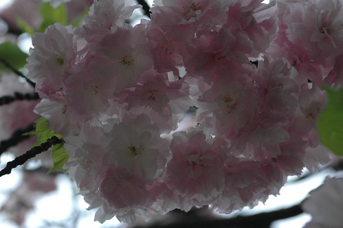
Here’s the flower of Accolade, shown on the map above. I could have lightened this image up a bit, but it was a cold, overcast day, threatening rain. The dark tones reflect the feeling of the afternoon when I visited.

Prunus 'Accolade'

The rain will stop by Saturday afternoon. Sunday will be a good day for Hanami! It’s also BBG Members’ Forsythia Day on Sunday. I’ll be there to pick up my Forsythia and my signature plants.

Related Posts

Introducing the BBG Hanami Flickr Group, April 3, 2008

Links

Flowering Cherries at BBG
BBG’s new Hanami Flickr group

Introducing the BBG Hanami Flickr Group

Cherry Blossoms from the 2006 Hanami at BBG, one of my photos I’ve already added to BBG’s new Hanami Flickr Group
Cherry Blossoms

This Saturday is the official opening of Hanami, the Cherry Blossom Viewing Season, at the Brooklyn Botanic Garden. Last week, inspired by the success of the Brooklyn Botanic Garden Visitors group on Flickr, BBG launched a new Flickr group, Hanami: Cherry Blossom Viewing at Brooklyn Botanic Garden:

The blossoming of the cherry trees at Brooklyn Botanic Garden is a New York City rite of spring. Hanami is the Japanese cultural tradition of viewing and cherishing each moment of the cherry blossom season.

Join Brooklyn Botanic Garden in celebrating Hanami this year by adding your cherry blossom pictures to our group!

Any Flickr member can join and add their photos. No invitation is needed. At the moment of this writing, there are already 14 members and 20 photos in the pool. We can expect to see hundreds of photos by the end of Hanami.

Earlier this week, BBG contacted me to ask for some suggestions on how to get the group started. Based on those email conversations, and discussions in the group itself, they’ve come up with the following guidelines:

Any photos you have taken of flowering cherries at BBG are welcome for submission–from any time in the blooming cycle. Hanami is the official cherry blossom viewing season here at the Garden (this year it’s from April 5 to May 11), but if you’ve got shots of early- or late-bloomers, we’d love to see them, too!

Please tag your photos with “Hanami” and “BBG” or “Brooklyn Botanic Garden.”

Related Posts

Events and Resources: Hanami and more at the Brooklyn Botanic Garden, April 3, 2007

Links

Flowering Cherries at BBG is the home page for all your Hanami needs

Weather Alert: Flood Watch Tonight and Tomorrow

Brooklyn Category 1-4 Coastal Storm Impact Zones. Yellow areas are most at risk from this storm, especially during high tide tomorrow morning.
Brooklyn Category 1-4 Coastal Storm Impact Zones

The National Weather Service has issued a flood watch which includes Brooklyn starting later tonight and continuing into tomorrow:

The National Weather Service has issued a Flood Watch beginning Tuesday, March 4, at midnight. The Watch is expected to stay in effect until Wednesday afternoon, March 5. Rainfall totals may reach 2.5 inches in New York City, with localized flooding possible, and minor coastal flooding likely at high tide on Wednesday morning.
NYC OEM email alert

New Yorkers should exercise caution, as heavy rain may knock down trees and power lines, and may create hazardous driving conditions. People should avoid walking or driving through moving water, as six inches of fast-moving water can knock people off their feet; two feet will cause most vehicles to float.

Links

NYC Office of Emergency Management:

Endangered Coney Island Community Gardens

Update 2008.02.05: Added link to More Gardens! Web site. This is one of the topics on the agenda for their general meeting this Thursday evening. See my Google Calendar in the sidebar for details.


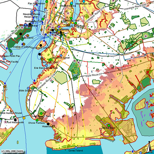
Community Gardens in Coney Island. Map Credit: OASIS
Map of Community Gardens in Coney Island

West of the subway stations and main attractions at Coney Island lie several community gardens, shown in light green on the map above. City community garden activists have identified three of them, highlighted on the Google Map below, as critically in danger of being lost to development.


View Larger Map

These three endangered gardens are under the jurisdiction of NYC’s Department of Housing Preservation and Development (HPD). They do not have the protection conferred to most other community gardens in New York City by transfer to Parks or purchase by the Trust for Public Land.

Surf Side Garden
2829 Surf Avenue, corner of West 29th Street

Unity Tower Tenant Association
1917 Surf Avenue, corner of West 20th Street
Founded in April 1993

Senior Citizens Block Association of Mermaid Ave
2917 West 20th Street, between Surf and Mermaid Avenues

Links

More Gardens!
Gardens To Close as Coney Prepares for Building Boom, Brooklyn Eagle, March 5, 2008

Brooklyn Mulchfest 2008: Locations and Dates

Update 2008.01.06: I’ve added a post with photos from today.
Update 2008.01.05: I have photos from my stint at Park Circle today.
Update 2008.01.04: I will be volunteering at the Park Circle location Saturday and Sunday for as long as I can hold out. Hope to see some of you there!


Mulchfest 2008 is on! You can drop-off trees at Greenwood Cemetery, 25th Street and 5th Avenue, starting today through January 11, any time between 8am and 4:30pm. Starting this Thursday, January 3 through Wednesday, January 16, you can leave trees curbside for pickup. Be sure to first remove all lights, ornaments, decorations, tree-stands and what-not before turning your tree into mulch.

The big event is this weekend. This Saturday and Sunday, January 5 & 6, from 10am to 2pm, you can bring your tree to multiple Parks locations throughout the city. This map shows all the Brooklyn locations for Mulchfest 2008. On-site chipping locations are indicated by the green tree icons. Drop-off only locations are indicated by the arrow&star icons.


View Larger Map

OTBKB reports reports that volunteers are needed for the Prospect Park locations. This seems like a good way to get out this weekend, meet some neighbors, and benefit your parks and community. To volunteer or for more information call (718) 965-8960 or email volunteers@prospectpark.org.

Starting today, January 1 through January 11, you can drop-off trees at Greenwood Cemetery, 25th Street and 5th Avenue, any time between 8am and 4:30pm.

Starting this Thursday, January 3 through Wednesday, January 16, you can leave trees curbside for pickup.

This Saturday and Sunday, January 5 & 6: 10am to 2pm, multiple locations.

Saturday, January 12: Chipping at Greenwood Cemetery, 25th Street and 5th Avenue.

Links

MulchFest 2008

12/12: Imagine Flatbush 2030 Workshop #2

Imagine Flatbush 2030 Winning Logo, Credit: Imani Aegedoy, 11-9-2007
Imagine Flatbush 2030 Logo
Next week, on Wednesday, December 12, the second community workshop of Imagine Flatbush 2030 will be held at Brooklyn College:

Come and participate in a special dialogue about the future of Flatbush. The Flatbush Development Corporation (FDC) and the Municipal Art Society (MAS) are inviting you to take part in Imagine Flatbush 2030—a community visioning and dialogue process—designed to get you together with other Flatbush community members to collectively create a more sustainable neighborhood. If you care about the environment, community health, protecting diversity, ensuring affordable housing and a whole host of other community issues, this is the meeting for you!

When: Wednesday, December 12th @ 6:30 pm
Where: Brooklyn College Student Center, 6th Floor
East 27th St. & Campus Road
(ramp entrance near Amersfort Place, see map below)

The star highlights the location of IF2030 Workshop . The closest subway stop is the 2/5 Brooklyn College-Flatbush Avenue / Nostrand Avenue station. North is to the lower-right in this map.
Imagine Flatbush 2030: Location of Workshop#2

For more information and to RSVP, please contact Sideya Sherman, at the MAS Planning Center, at 212/935-3960 or via email at ssherman@mas.org.

Please be advised that there will be a supervised homework room provided for school aged children. If you need to bring a child, please contact us in advance.

Refreshments will be served

Related Posts

IF2030 on the Brian Lehrer Show, earlier today
The Albemarle Road Pedestrian Bridge, November 25
Imagine Flatbush 2030, November 20

Links

Imagine Flatbush 2030, Municipal Art Society

Where is Flatbush, Anyway?

Update 2007.11.04: For others’ reactions to the Times piece, see the Links at the end of this post, or check out the list on Brooklyn Junction. Also added a link to a 1998 letter to the editor about their invention of “Greater Ditmas Park.”


Map of Flatbush in 1873
Map of Flatbush, 1873


Today, the “Living In” feature of the Real Estate section of the New York Times looks at Flatbush:

More than a neighborhood, Flatbush often refers to a sprawling community in central Brooklyn comprising multiple smaller ones.
… But many smaller neighborhoods traditionally under the Flatbush umbrella, including Ditmas Park and Prospect Park South, have asserted distinct identities. So, the character of what might be called Flatbush proper — a rectangle anchored at the south by Brooklyn College — has come into sharper focus.
Note to City Dwellers: Steals Available Here

The article claims “the borders of Flatbush are ambiguous”:

Neighborhoods once considered part of it have reclaimed their more specific names. Today, its western border is generally considered Ocean Avenue, beyond which are the various parts of Victorian Flatbush. Its eastern border is New York Avenue, beyond which is East Flatbush. The northern boundary is Parkside Avenue; on the south it is the Long Island Rail Road tracks, just above Avenue I.

This is not the first time the Times has gotten confused about the boundaries of the area. In 1998, they invented the term “Greater Ditmas Park” to cover several other neighborhoods, and a West Midwood resident took them to task for it:

Ditmas Park, along with Prospect Park South, Beverley Square West, West Midwood, South Midwood, Fiske Terrace, and the other neighborhoods in the area discussed are not part of ”Greater Ditmas Park” but of Flatbush.

Maybe that’s where Corcoran picked up their bad habits.

Part of the ambiguity is that the name “Flatbush” is used at two different scales, at least. There was the old Village, then town, of Flatbush, located along what was a trading trail and became the Flatbush Avenue of today. There was also the Township of Flatbush prior to consolidation, with Brooklyn in 1894, then with New York City in 1898. The township included the farmlands to the west of the town of Flatbush. These were developed at the turn of the last century into the “many smaller neighborhoods” the Times mentions.

The Township of Flatbush also extended north of the Times designation, bordering the Township of Brooklyn. In the Brooklyn Botanic Garden, a few hundred feet in from its southwestern entrance near the Carousel in Prospect Park, is a brass line and plaque marking this boundary:

Brooklyn-Flatbush Boundary Marker

Brooklyn-Flatbush Boundary Marker

Brooklyn-Flatbush Boundary Marker

The only substantial community garden in the area also gets a mention:

In 2002, the couple bought a one-bedroom co-op on Glenwood Road with an eat-in kitchen and spacious foyer … They started meeting neighbors through a residents’ association and the Campus Road garden, a community garden at Brooklyn College. In addition to the pleasure of tending their 10-by-13-foot plot, they enjoy summer social gatherings in the garden.

Related Posts

Forgotten Flatbush: The Albemarle Road Pedestrian Bridge

Links

Across the Park
Brooklyn Junction
Ditmas Park Blog
Fading Ad Blog
Hawthorne Street

Forgotten Flatbush: The Albemarle Road Pedestrian Bridge

In the first Imagine Flatbush 2030 workshop, we enumerated “Assets” and “Challenges”. At our table – and it sounded like the experience was shared at others’ – where someone lived emerged as a primary determinant of what appeared in which category. Sometimes shared concerns, such as transportation, appeared as both an asset and a challenge, depending on where one lived. It became clear to me that the lines can be sharply drawn, sometimes block-by-block.

I’m a newcomer to the area, having moved here only in Spring of 2005. I researched more and more about the area and its history as we committed to buying a home and moving here. I’ve still only visited a small portion of Flatbush. IF2030 is making me curious about exploring more of it.

Part of what I want to explore more of is literally “on the other side of the tracks” from where I make my home. The B/Q subway line runs through this neighborhood as an open trench. There are several places where there is no crossing, and the cut forms a geographical barrier, a steel river, separating one side from the other. It wasn’t always so. With homage to Forgotten NY, here’s a little piece of Flatbush that’s not quite forgotten, still part of living memory, the Albemarle Road pedestrian bridge.

Google Map of the location of the old Albemarle Road pedestrian bridge. 143 Buckingham Road is also highlighted; it’s a landmark in all the historical photos of this crossing. The markers show where I took the photos for this article.

View Larger Map

The BMT as I remember — never rode it much, but had relatives on East 17th & Beverley Road. We would always go to the Albemarle Road footbridge by the tennis courts over the BMT cut, and watch the trains.
– Steve Hoskins, SubTalk Post #93389, NYC Subway

Eastern Dead End of Albemarle Road at Buckingham Road. 143 Buckingham Road is at the left of the photograph.
Dead End, Albemarle Road at Buckingham Road

Western foundation of Albemarle Road Pedestrian Bridge

“I seem to have a memory – or is it just a dream? – going back to my earliest childhood, associated with a place about a mile in a different direction from where I lived, towards Prospect Park: it is a stretch of about five blocks of Albemarle Road, going from the Brighton subway underpass to Coney Island Avenue. One got there from our side of the subway tracks by crossing over on a small footbridge. On the far end of the bridge, Albemarle Road suddenly widens, and in the middle of it there is a traffic island, covered with trees and extending a 11 the way to Coney Island Avenue; there are also trees on both sides of the street. My first encounters with this scene are in my memory entirely intermingled with my dreams of it, a recurring vision of overwhelming loveliness at the edge of things, beyond which something entirely new and different must lie.”
– Ronald Sanders, A Brooklyn Memoir, via Living in Victorian Flatbush

Western Dead End of Albemarle Road near East 17th Street. 143 Buckingham Road is at the right of the photograph, across the tracks.
Western Dead End, Albemarle Road, near East 17th Street

East Foundation of Albemarle Road Pedestrian Bridge. 143 Buckingham Road is in the center, across the tracks.
East Foundation of Albemarle Road Pedestrian Bridge

Albemarle Road is interrupted by the subway cut for the B/Q lines. In the late 19th Century, several rail lines were developed to take passengers from the City of Brooklyn, what we now think of as downtown Brooklyn, through the other villages and towns such as Flatbush, to the beach resorts on Coney Island and Brighton Beach. By the 1870s the Brooklyn Coney Island Railroad ran along Coney Island Avenue. By the 1890s, the Brooklyn, Flatbush and Coney Island Railroad (BF&CI) ran along what is now the current route of the B/Q subway line. Most of Flatbush was still farmland at the time. When the Flatbush farms were sold and the area was developed at the turn of the 20th Century, the tracks still ran at grade.

In this 1873 map of Flatbush, Prospect Park and the Parade Grounds are already laid out to the north, and the Brooklyn Coney Island Railroad runs along Coney Island Avenue. On this map, Parkside Avenue is named Franklin Avenue, Church Avenue is named Church Lane, and Cortelyou Road is named Turner Harrow (or Narrow?) Lane. The Waverly Avenue shown on this map no longer exists; it’s later replaced by Albemarle and Beverly Roads Road, whose future locations are shown, but neither named nor yet built. The future route of the B/Q line is not shown. The families whose landholdings and houses appear on this map lent their names to several streets and neighborhoods: Turner, Hinkley, Ditmas and Vanderveer.
Map of Flatbush, Brooklyn, 1873

In an 1888 USGS Survey Map of Brooklyn, just a small portion of which is shown here, Waverly Avenue has been “de-mapped.” The roads built in its place, unnamed on this map, are Avenues B and C; these will be renamed later to Beverly and Cortelyou Roads. Between them run East 11th through East 14th Streets; in the early 1900s, these will be renamed to Stratford, Westminster, Argyle and Rugby Roads to cash in on the cachet of Prospect Park South. The BF&CI, which began service in July 1878, is also now in place. East of that, the eastern half of Avenue A (Albemarle Road) has been built, along with East 17th through 19th Streets.
Detail, 1888 USGS Survey Map of Brooklyn

Through the early 1900s, all these railroad lines ran at grade, at street level. There were also trolley lines, at first horse-drawn, then later electrified, on many of the crossing streets. Development brought a burgeoning residential population, more traffic, and more traffic conflicts and accidents. The decision was made to separate the rail and street traffic by moving them to different levels, passing above and below each other.

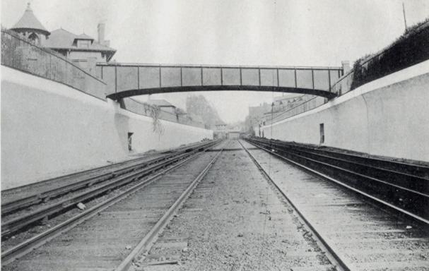
This photo from the 1918 “Reports of the Brooklyn Grade Crossing Elimination Commission” shows the Albemarle Road Footbridge. The line has been widened to four tracks and now runs below grade. Today, the local Q train runs on the outer tracks, while the express B runs on the inner tracks. 143 Buckingham Road is visible on the upper left of the photograph. Thanks to Art Huneke for permission to use this photograph. This photo appears on his page Brighton Beach Line, Part 3.
Albemarle Road Footbridge

The physical contrasts could hardly be stronger across the tracks: a wide, tree-lined boulevard with large, detached wood-frame houses on one side, and tall, multiple-unit residential buildings with few trees on the other. It is tempting to imagine what it would be like to restore the pedestrian bridge, eliminating at least a geographical barrier between these two halves of the same neighborhood. Would it help us to make other connections, to recognize our common assets and challenges, and work together to create a future we can all live with?

Related posts

Imagine Flatbush 2030

Links

My Flickr photo set
Brighton Line, NYC Subway
ARRT’s Archives, Art Huneke’s Web site
Rapid Transit Net
The Brooklyn Grade Crossing Elimination Project, 1903-1918